Showing 221–240 of 271 results
-

 576
576
[insert page='description' display='content']
| Variant: Basic |
| Slide size: On-Screen Show (16:9) |
| Color set: CS002 |
| Projection: Robinson |
| Main layer: Whole World w/o Antarctica and Lakes |
| Detail level: Normal Detail |
|
$10.0
-

 498
498
[insert page='description' display='content']
| Variant: Basic |
| Slide size: On-Screen Show (16:9) |
| Color set: CS001 |
| Projection: Robinson |
| Main layer: Whole World w/o Antarctica and Lakes |
| Detail level: Normal Detail |
|
$10.0
-

 417
417
[insert page='description' display='content']
| Variant: Basic |
| Slide size: On-Screen Show (16:9) |
| Color set: CS024 |
| Projection: Robinson |
| Main layer: Whole World |
| Detail level: Low Detail |
|
$10.0
-

 339
339
[insert page='description' display='content']
| Variant: Basic |
| Slide size: On-Screen Show (16:9) |
| Color set: CS014 |
| Projection: Robinson |
| Main layer: Whole World |
| Detail level: Low Detail |
|
$10.0
-

 261
261
[insert page='description' display='content']
| Variant: Basic |
| Slide size: On-Screen Show (16:9) |
| Color set: CS010 |
| Projection: Robinson |
| Main layer: Whole World |
| Detail level: Low Detail |
|
$10.0
-

 183
183
[insert page='description' display='content']
| Variant: Basic |
| Slide size: On-Screen Show (16:9) |
| Color set: CS009 |
| Projection: Robinson |
| Main layer: Whole World |
| Detail level: Low Detail |
|
$10.0
-

 105
105
[insert page='description' display='content']
| Variant: Basic |
| Slide size: On-Screen Show (16:9) |
| Color set: CS002 |
| Projection: Robinson |
| Main layer: Whole World |
| Detail level: Low Detail |
|
$10.0
-

 27
27
[insert page='description' display='content']
| Variant: Basic |
| Slide size: On-Screen Show (16:9) |
| Color set: CS001 |
| Projection: Robinson |
| Main layer: Whole World |
| Detail level: Low Detail |
|
$10.0
-

 2294
2294
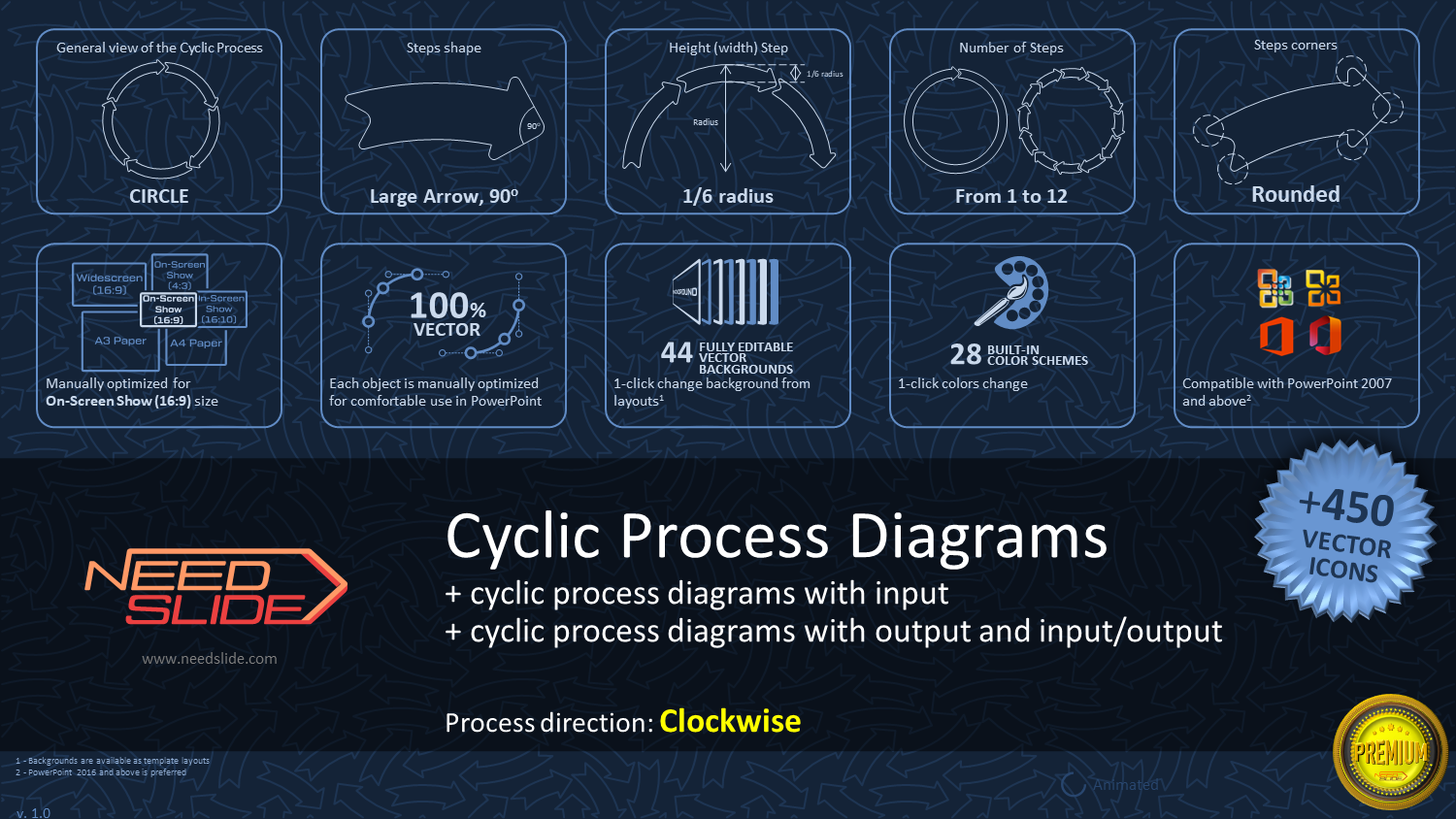
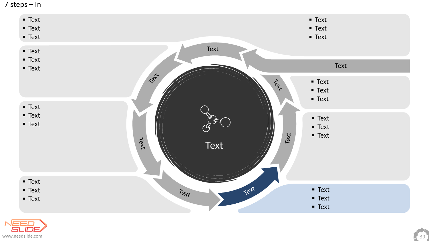
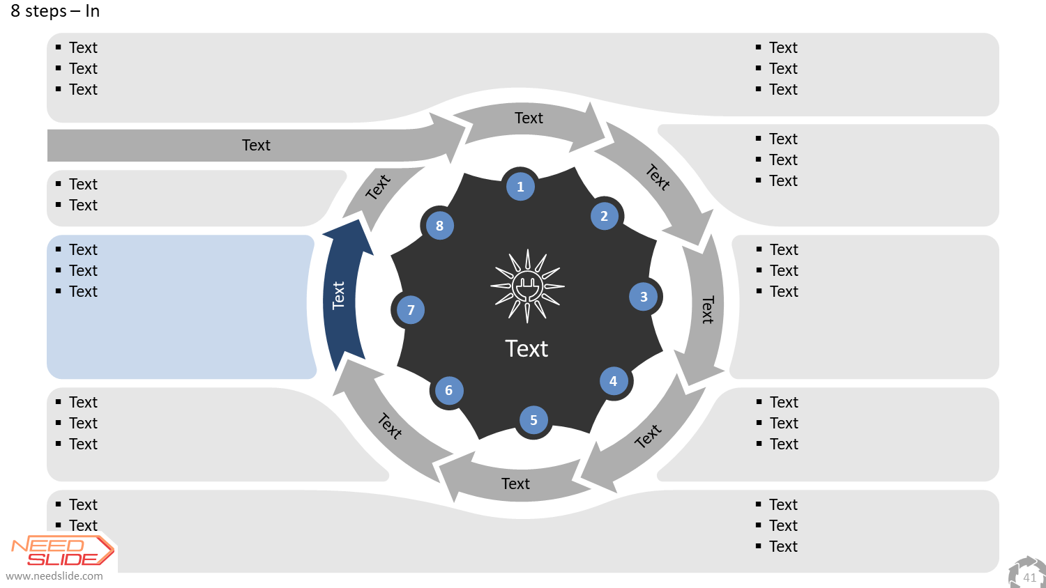
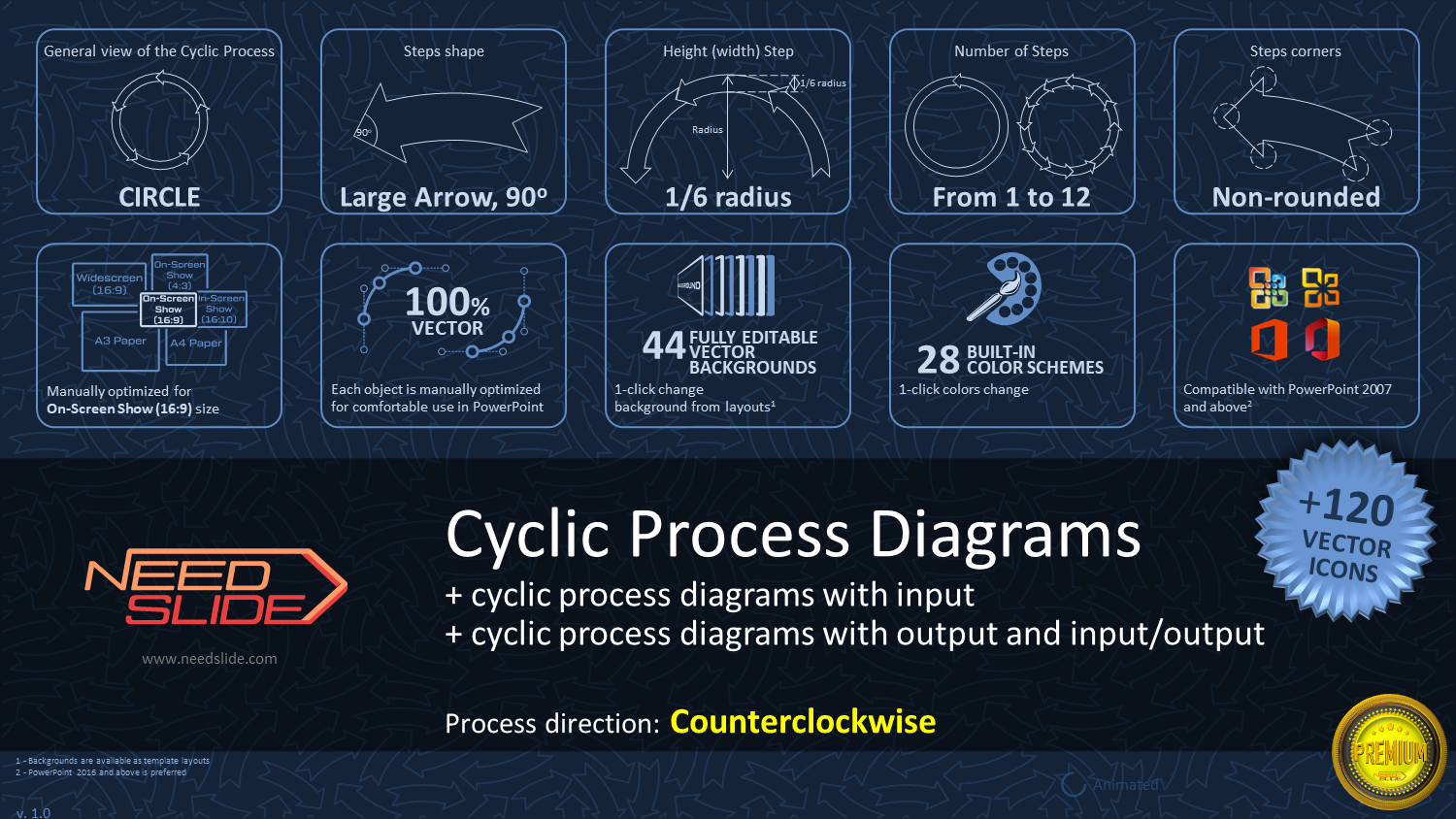
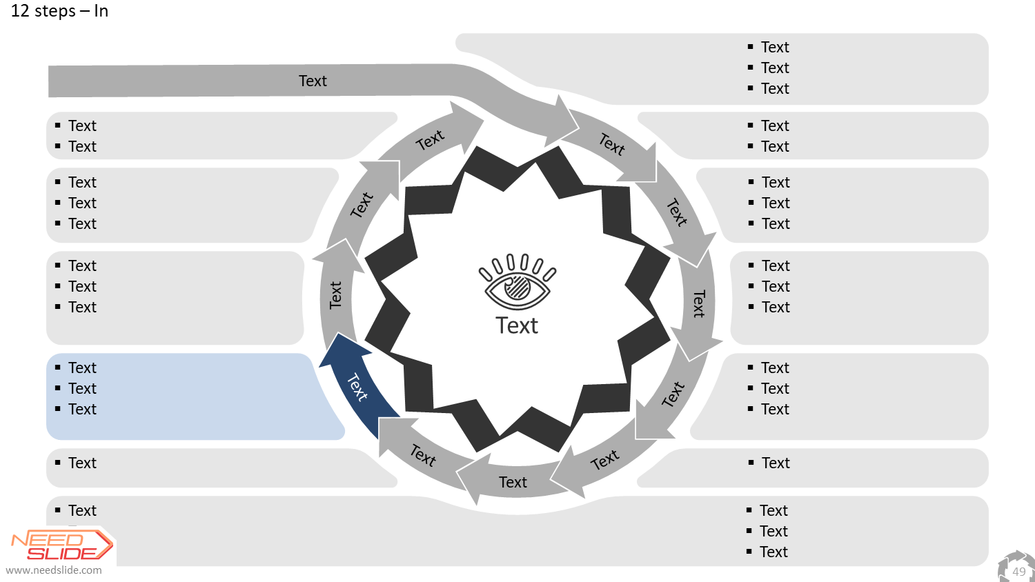
[insert page='cyclic-process-diagram-description' display='content']
| Slide Size: On-Screen Show (16:9) |
| Color Set: CS034 (28 Color Schemes) |
| General view of the Cyclic Process: Circle |
| Number of Steps: from 1 to 12 |
| Steps connections shape: Large Arrow, 90° |
| Height (width) of Steps: 1/6 of the radius |
|
$9.0
-
 2291
2291
[insert page='cyclic-process-diagram-description' display='content']
| Slide Size: On-Screen Show (16:9) |
| Color Set: CS034 (28 Color Schemes) |
| General view of the Cyclic Process: Circle |
| Number of Steps: from 1 to 12 |
| Steps connections shape: Large Arrow, 90° |
| Height (width) of Steps: 1/6 of the radius |
|
$9.0
-

 2288
2288
[insert page='cyclic-process-diagram-description' display='content']
| Slide Size: On-Screen Show (16:9) |
| Color Set: CS034 (28 Color Schemes) |
| General view of the Cyclic Process: Circle |
| Number of Steps: from 1 to 12 |
| Steps connections shape: Large Arrow, 90° |
| Height (width) of Steps: 1/6 of the radius |
|
$9.0
-

 2285
2285
[insert page='cyclic-process-diagram-description' display='content']
| Slide Size: On-Screen Show (16:9) |
| Color Set: CS034 (28 Color Schemes) |
| General view of the Cyclic Process: Circle |
| Number of Steps: from 1 to 12 |
| Steps connections shape: Large Arrow, 90° |
| Height (width) of Steps: 1/6 of the radius |
|
$9.0
-

 2282
2282
[insert page='cyclic-process-diagram-description' display='content']
| Slide Size: On-Screen Show (16:9) |
| Color Set: CS034 (28 Color Schemes) |
| General view of the Cyclic Process: Circle |
| Number of Steps: from 1 to 12 |
| Steps connections shape: Large Arrow, 90° |
| Height (width) of Steps: 1/6 of the radius |
|
$9.0
-

 2279
2279
[insert page='cyclic-process-diagram-description' display='content']
| Slide Size: On-Screen Show (16:9) |
| Color Set: CS034 (28 Color Schemes) |
| General view of the Cyclic Process: Circle |
| Number of Steps: from 1 to 12 |
| Steps connections shape: Large Arrow, 90° |
| Height (width) of Steps: 1/6 of the radius |
|
$9.0
-
 2276
2276
[insert page='cyclic-process-diagram-description' display='content']
| Slide Size: On-Screen Show (16:9) |
| Color Set: CS034 (28 Color Schemes) |
| General view of the Cyclic Process: Circle |
| Number of Steps: from 1 to 12 |
| Steps connections shape: Large Arrow, 90° |
| Height (width) of Steps: 1/6 of the radius |
|
$9.0
-

 2273
2273
[insert page='cyclic-process-diagram-description' display='content']
| Slide Size: On-Screen Show (16:9) |
| Color Set: CS034 (28 Color Schemes) |
| General view of the Cyclic Process: Circle |
| Number of Steps: from 1 to 12 |
| Steps connections shape: Large Arrow, 90° |
| Height (width) of Steps: 1/6 of the radius |
|
$9.0
-

 418
418
[insert page='description' display='content']
| Variant: Basic |
| Slide size: On-Screen Show (16:9) |
| Color set: CS024 |
| Projection: Robinson |
| Main layer: Whole World w/o Antarctica |
| Detail level: Low Detail |
|
$9.0
-

 340
340
[insert page='description' display='content']
| Variant: Basic |
| Slide size: On-Screen Show (16:9) |
| Color set: CS014 |
| Projection: Robinson |
| Main layer: Whole World w/o Antarctica |
| Detail level: Low Detail |
|
$9.0
-

 262
262
[insert page='description' display='content']
| Variant: Basic |
| Slide size: On-Screen Show (16:9) |
| Color set: CS010 |
| Projection: Robinson |
| Main layer: Whole World w/o Antarctica |
| Detail level: Low Detail |
|
$9.0
-

 184
184
[insert page='description' display='content']
| Variant: Basic |
| Slide size: On-Screen Show (16:9) |
| Color set: CS009 |
| Projection: Robinson |
| Main layer: Whole World w/o Antarctica |
| Detail level: Low Detail |
|
$9.0
Showing 221–240 of 271 results