Need a World Map for your presentation — without starting from scratch?
The Multilayer World Map for PowerPoint helps you build clear, customized visuals in minutes. Use only the layers you need: countries, capitals, lakes, or graticules — all organized for quick editing and easy navigation. Text always stays visible thanks to a smart layer structure. All objects are named and searchable via the Selection Pane.
This is not a presentation or a presentation template – it is a flexible and convenient tool for quickly creating the desired world map for you.
Whether you’re preparing slides for class, explaining a concept, or sketching out an idea, this map saves time and helps you get the job done.
Overview of the Multilayer World Map for PowerPoint
1. Slide size: 16:9 widescreen
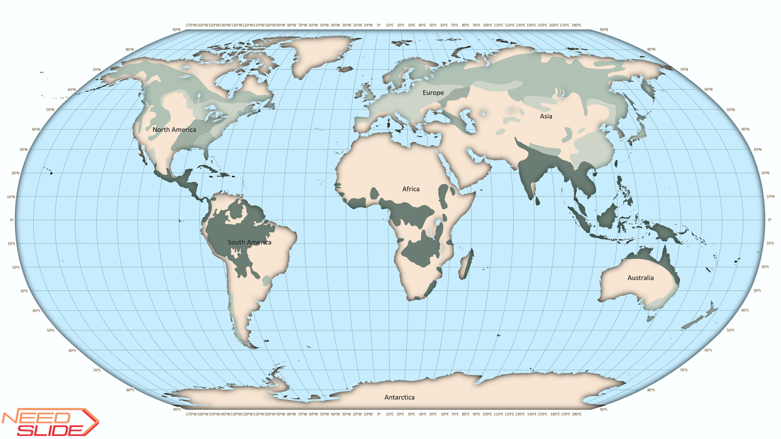
2. Projection: Robinson (slightly modified)
3. Map language: By default, the map is presented in English. But you can choose another language.
15 languages available now – Arabic, Bengali, Chinese, English, French, Georgian, German, Hindi, Indonesian, Italian, Japanese, Portuguese, Russian, Spanish, and Urdu.
Note: Geographical names in different languages may sound different and even have different meanings. Unfortunately, not all countries have an official list of geographical names. Moreover, the same geographical object may have several other names, even within one country. Therefore, if you think that you have found an error in the name of some geographical object, please let us know. We will be very grateful. Thank you!
Note: Quick Start Guide and Gifts are supplied only in English.
4. Map detail: Low detail or Normal detail or High detail at your choice
Note: A High detail map is not necessarily better than a Normal or Low detail map. Each detail option has its advantages and disadvantages:
High detail – looks the most professional, contains a large number of details, and has the largest selection of layers. However, due to the complexity and large number of objects, it can increase the size of the final file, and on very weak computers or laptops, it may cause a slight delay (up to 1 second) in the program’s response.
Normal detail – a universal option, a compromise between a professional look and performance. Suitable for most purposes, although it has a smaller selection of layers.
Low detail – very convenient for simple maps with a small number of elements. Looks simple and adds very little to the file size. Has the smallest number of layers.
5. Format: 100% vector-based graphics
6. Editability: Fully editable elements
7. Vector Optimization for PowerPoint: All vector objects have been optimized by reducing the number of nodes to the minimum necessary, ensuring smooth performance in PowerPoint.
8. Layer structure:
- Low detail map: 20 layers in total
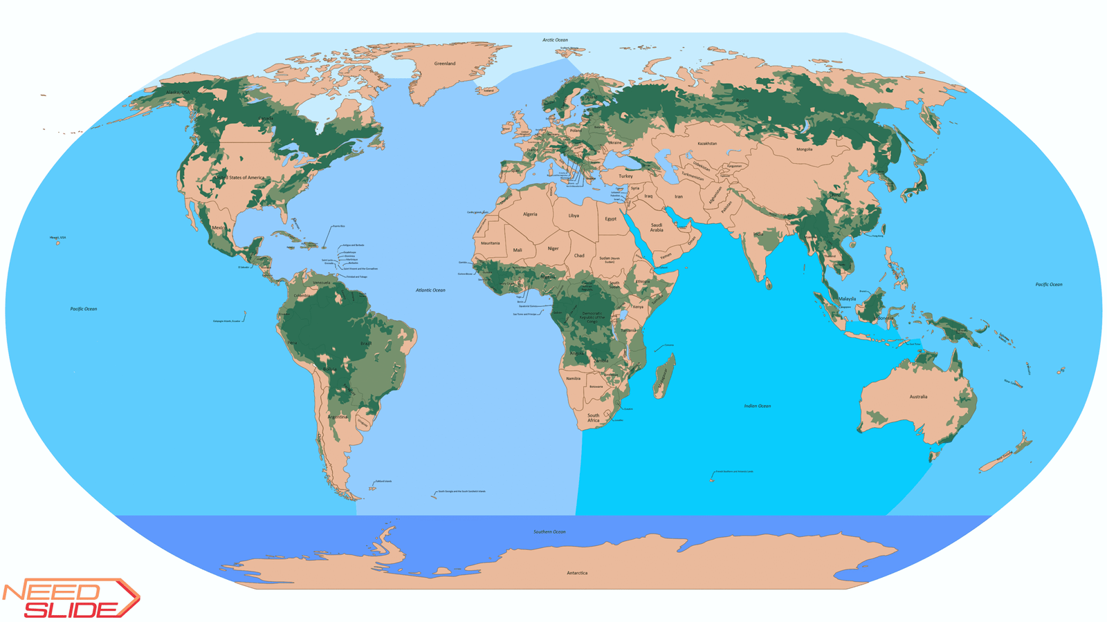
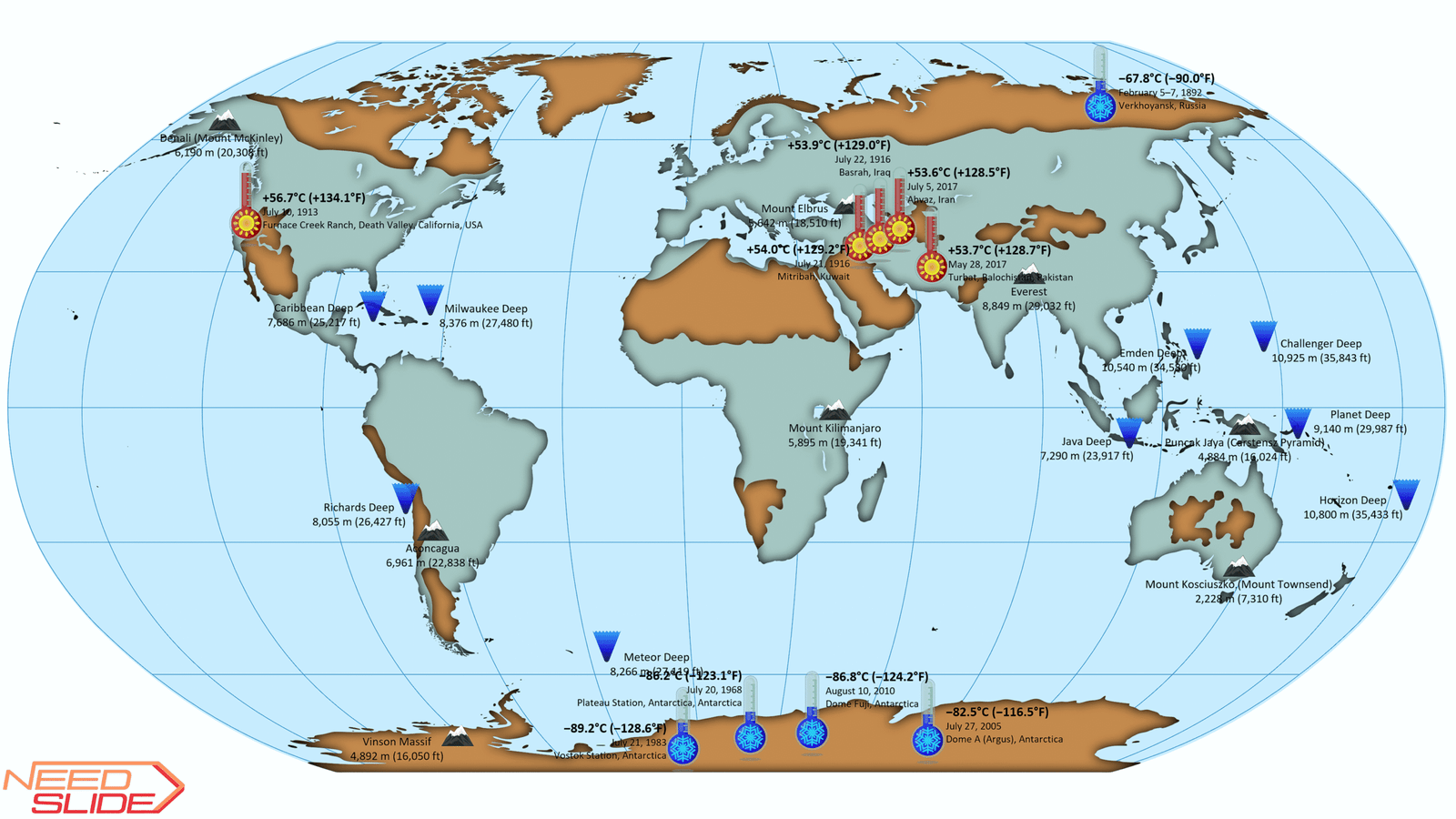
–12 vector layers: Capitals, Temperature Records, The deepest points in the world’s oceans, The highest peaks of each continent (“Seven summits”), Lakes, World forest cover, Countries and territories, 5 Continents (w/o Antarctica), Whole World, Graticule, 5 Oceans, and World Ocean
–8 text layers: Capitals, Temperature Records, The highest peaks of each continent (“Seven summits”), Countries and territories, 5 Continents (w/o Antarctica), The deepest points in the world’s oceans, 5 Oceans, Graticule
- Normal detail map: 33 layers in total
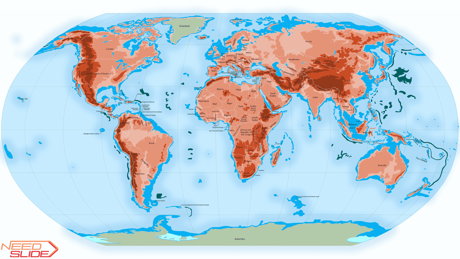
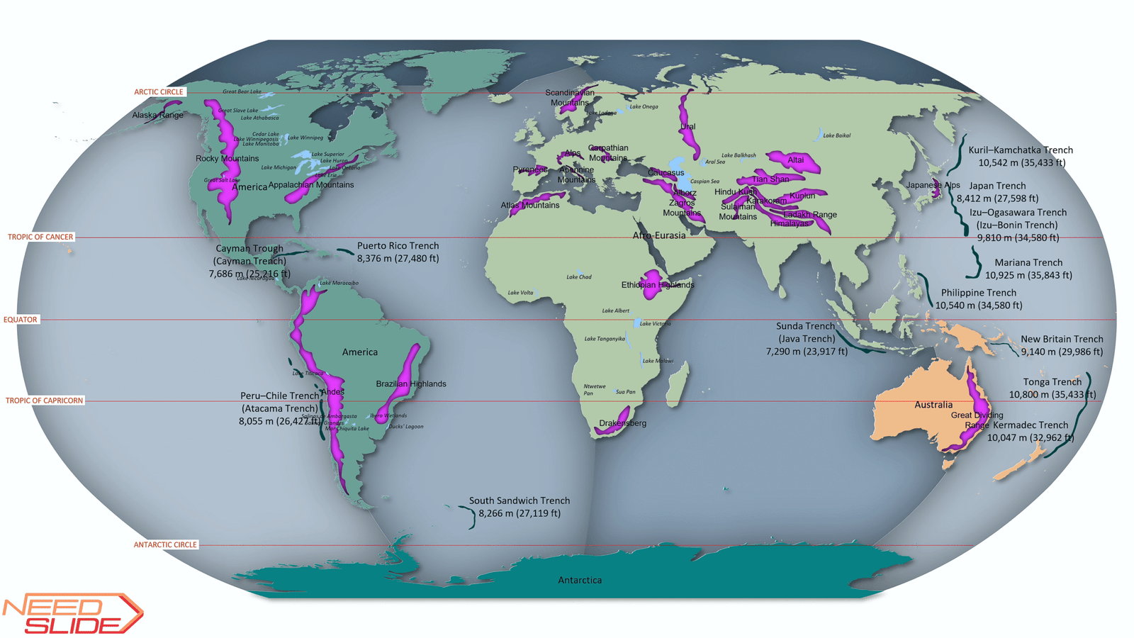
–19 vector layers: Capitals, Temperature Records, The highest peaks of each continent (“Seven summits”), The deepest points in the world’s oceans, Lakes, Rivers, Main Deserts of the World, Forest and woodland, Mountain Ranges, Countries and territories, Relief Map of the World, 6 Continents (Eurasia), 5 Continents (w/o Antarctica), Whole World, Graticule, Deepest oceanic trenches, 5 Oceans, and World Ocean
–14 text layers: Capitals, Temperature Records, The highest peaks of each continent (“Seven summits”), Mountain Ranges, Lakes, Rivers, Countries and territories, The deepest points in the world’s oceans, Deepest oceanic trenches, 5 Oceans, Graticule (2 options), 6 Continents (Eurasia), and 5 Continents (w/o Antarctica)
- High detail map: 64 layers in total
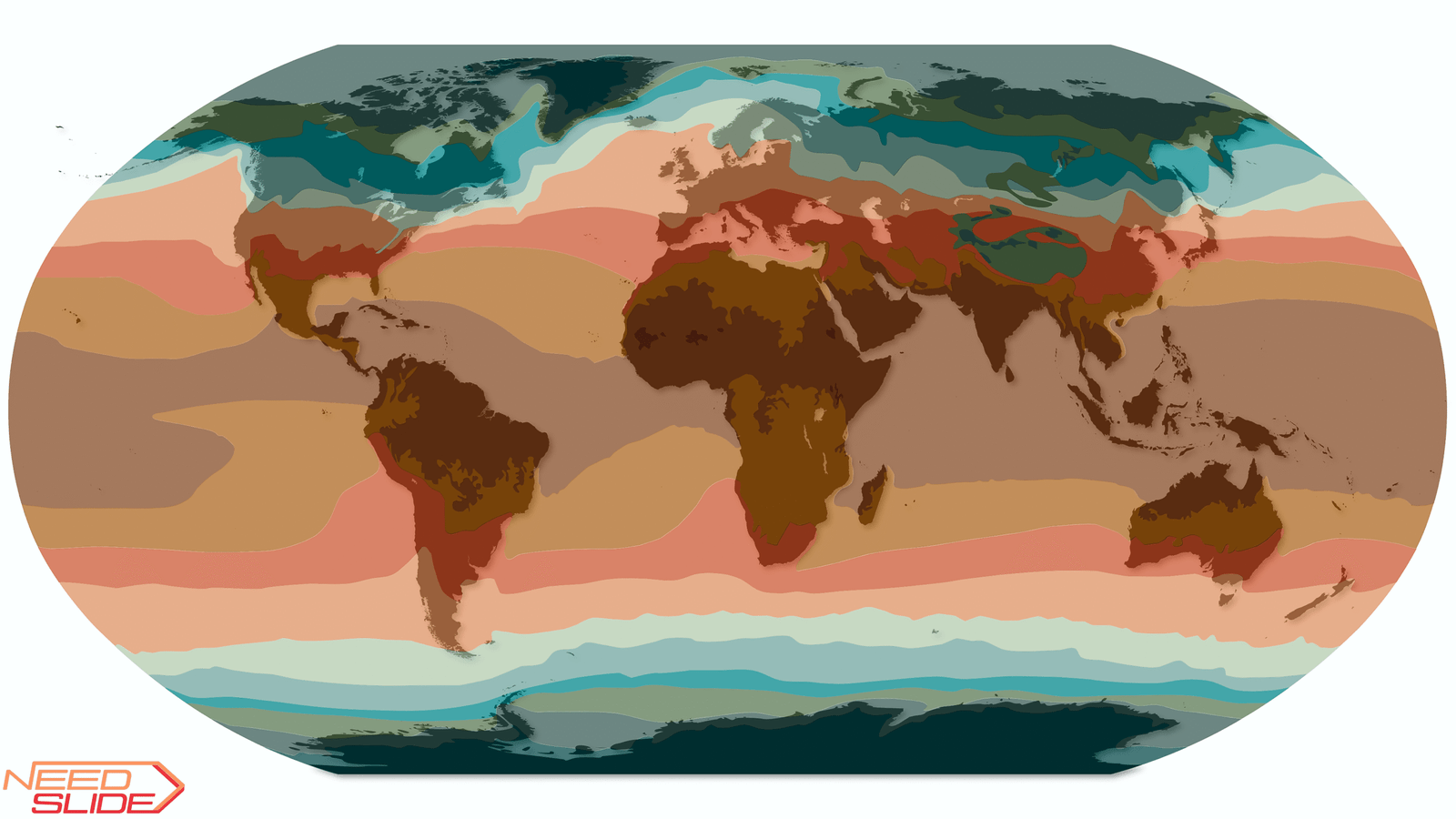
–36 vector layers: Capitals, Annual mean temperature, Temperature records of the continents, Temperature Records, The deepest points in the world’s oceans, The highest peaks of each continent (“Seven summits”), Roads, Rail Network, Lakes, Rivers, The Main Deserts of the World and their Types, Categories of wood of the world’s forests, Forest types of the world, Forest and woodland, Mountain Ranges, Countries and territories, 5 Major Circles of Latitude, Relief Map of the World, Continents (5 options), Whole World, Graticule (5 options), Deepest oceanic trenches, 7 Oceans, Seas, Gulfs, Straits, Oceans (4 options), and World Ocean
–28 text layers: Capitals, Temperature records of the continents, Temperature Records, The highest peaks of each continent (“Seven summits”), Mountain Ranges, Lakes, Rivers, Main Deserts of the World, Countries and territories, Countries and territories (ISO 3166), 5 Major Circles of Latitude, Graticule (5 options), Continents (5 options), The deepest points in the world’s oceans, Deepest oceanic trenches, 7 Oceans, Seas, Gulfs, Straits, and Oceans (4 options)
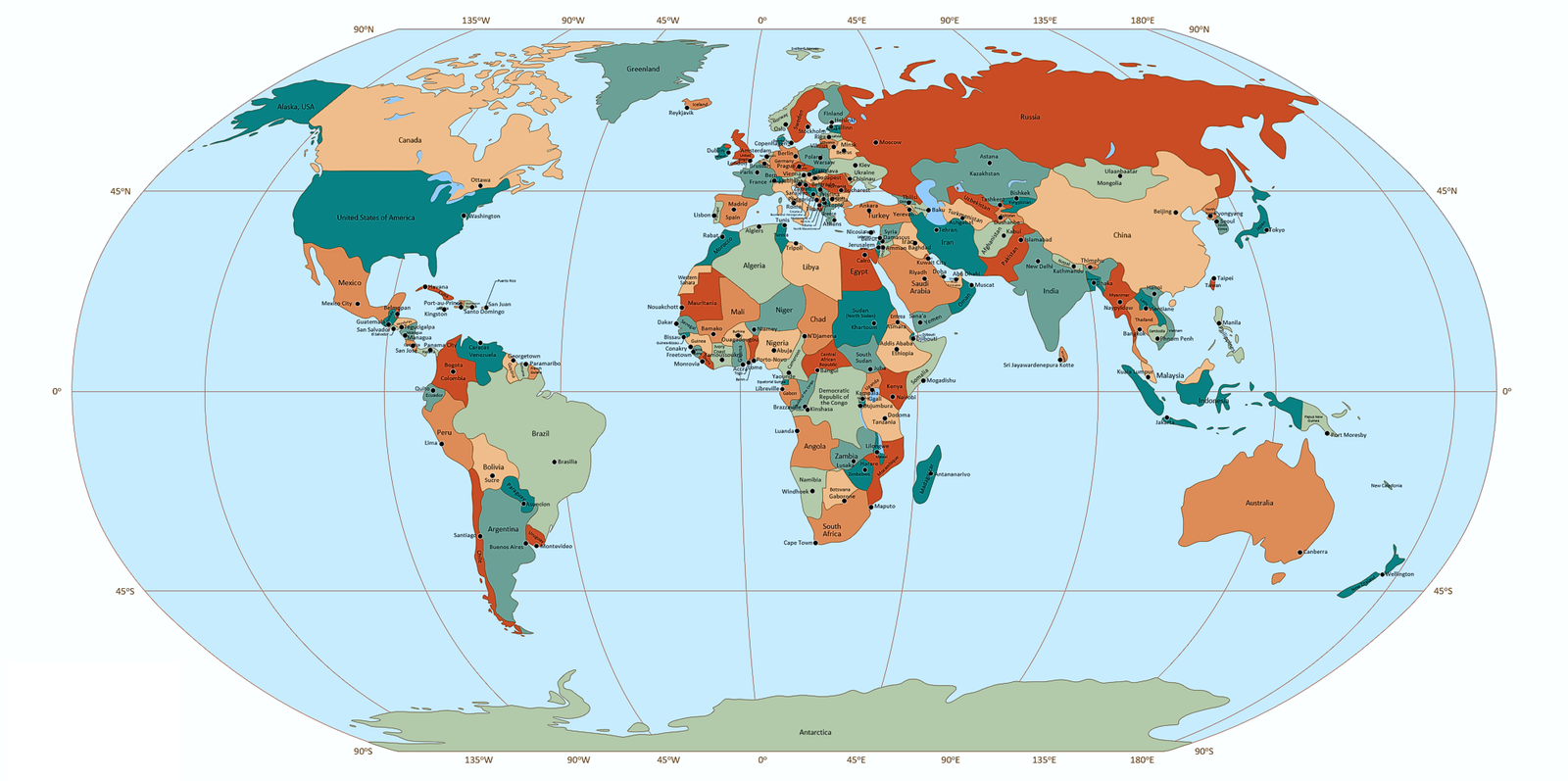
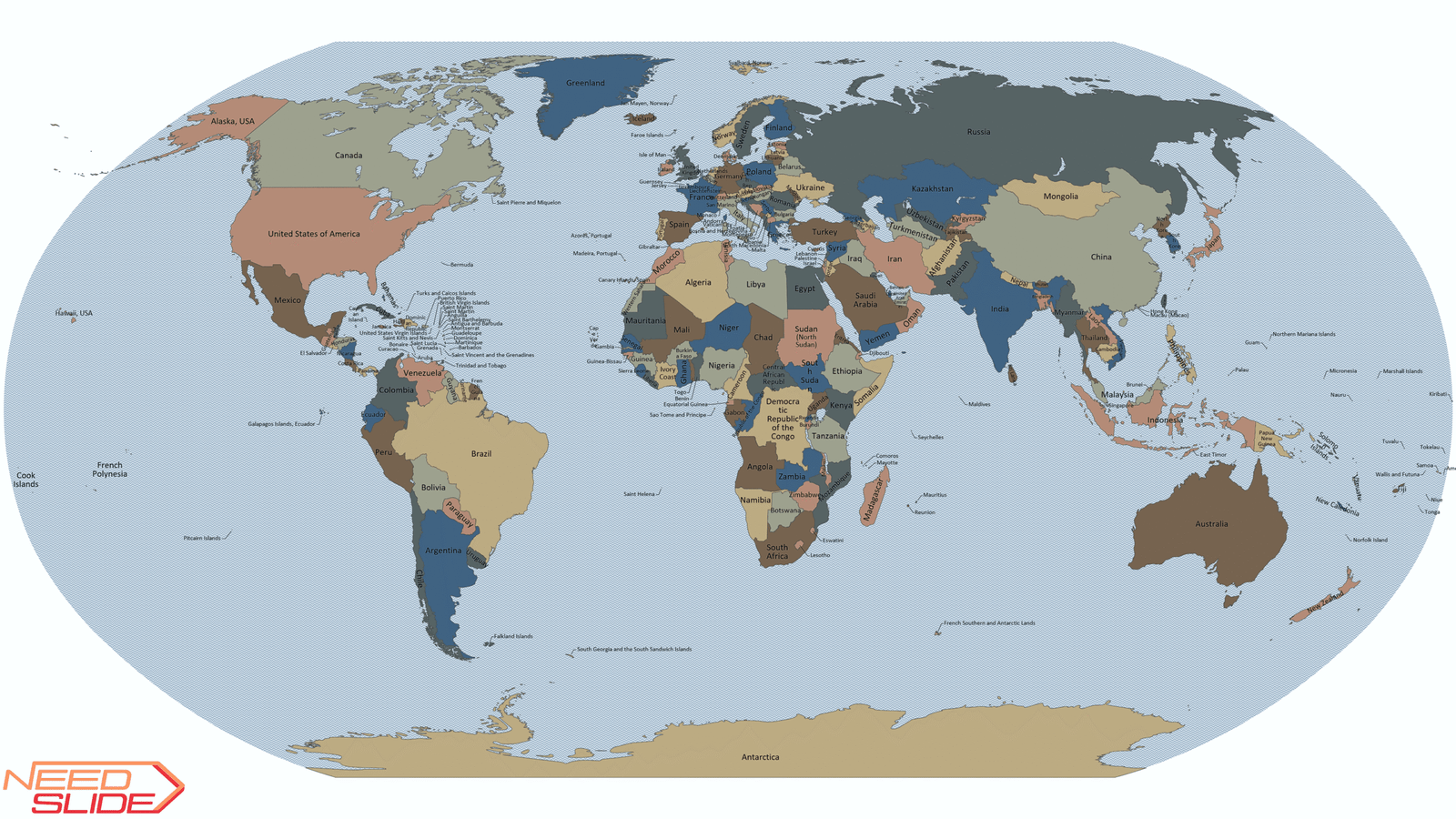
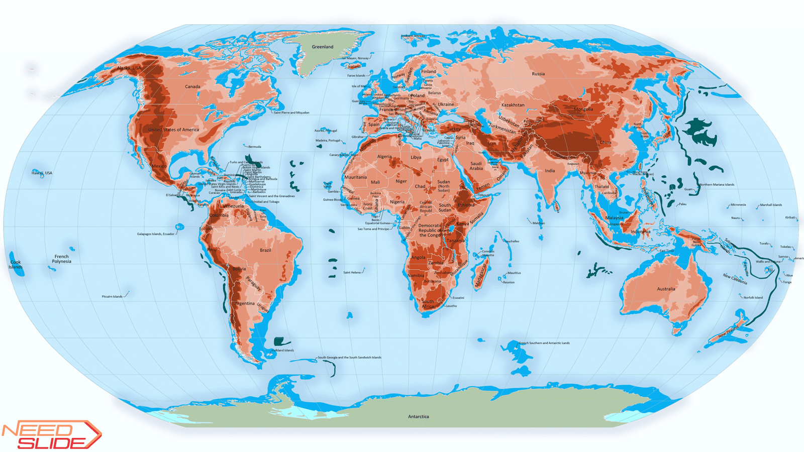
8. Layer Countries and territories:
- Low detail map: 164 objects
- Normal detail map: 194 objects
- High detail map: 248 objects
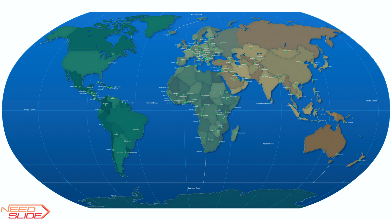
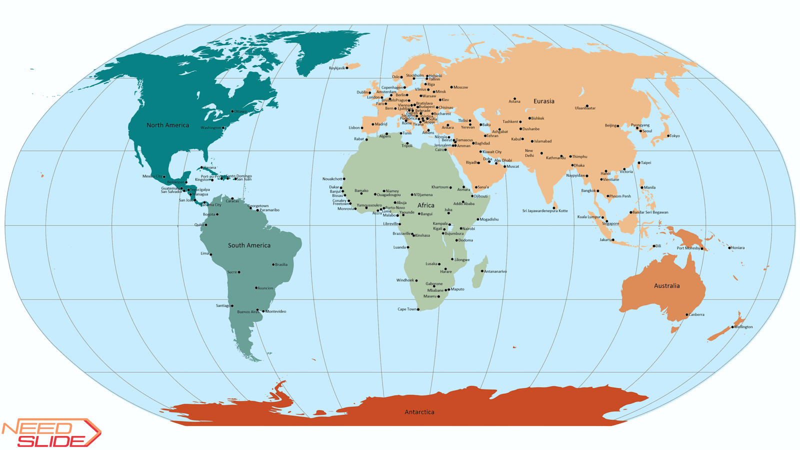
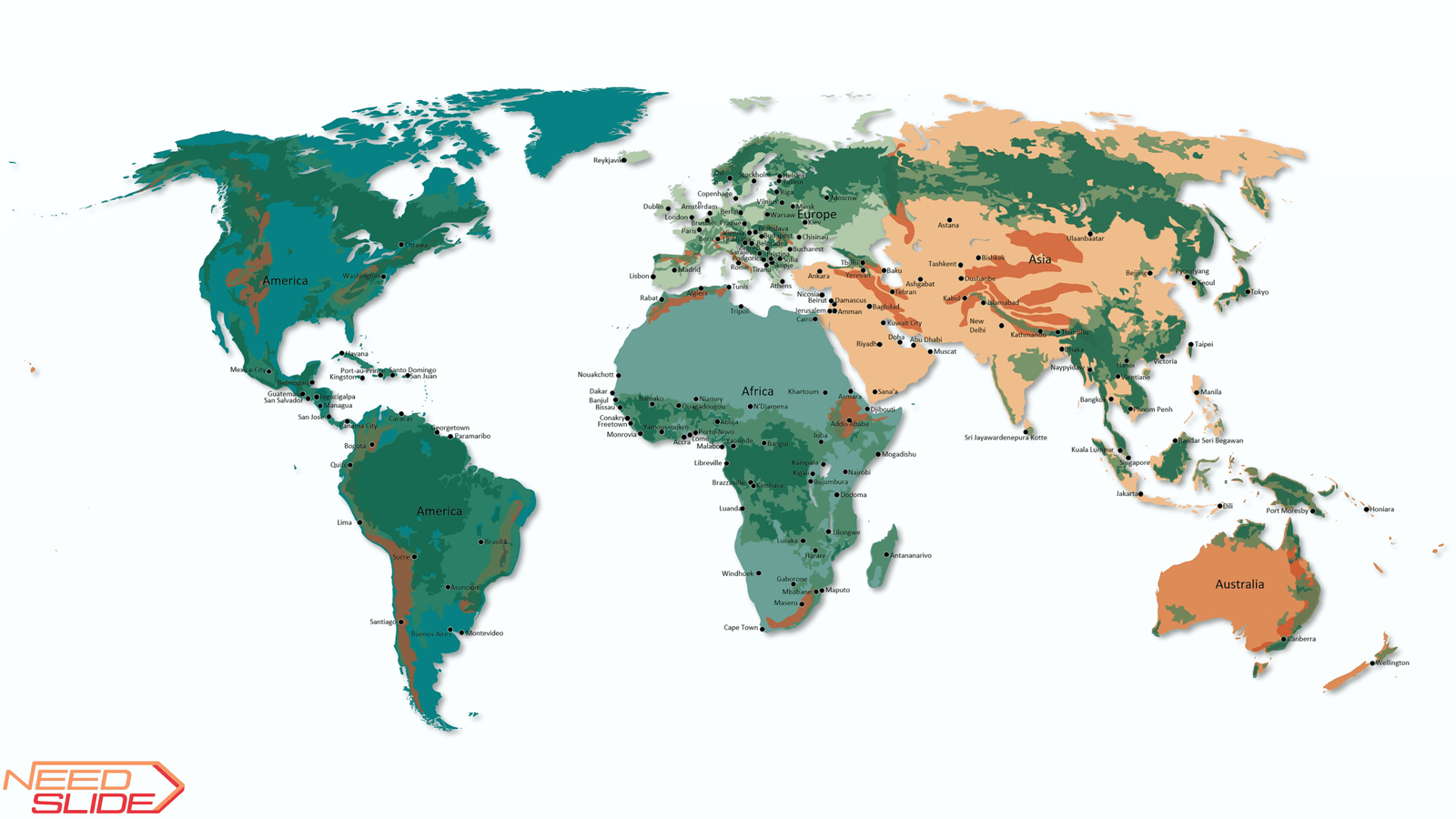
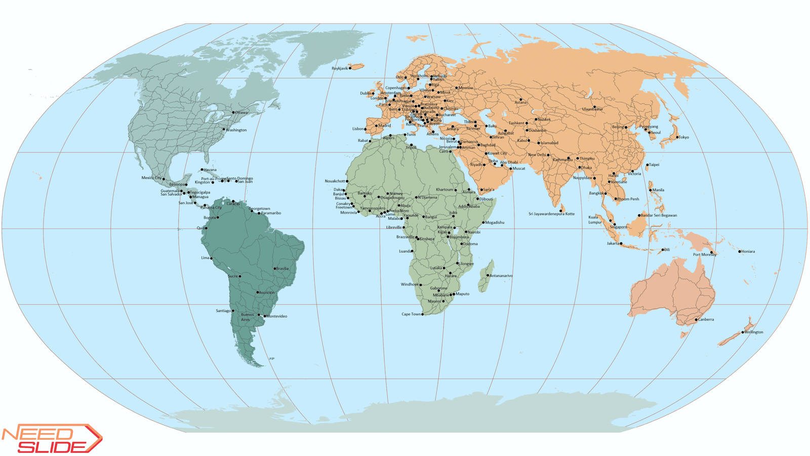
9. Layer Capitals:
- Low detail map: 156 objects
- Normal detail map: 164 objects
- High detail map: 165 objects
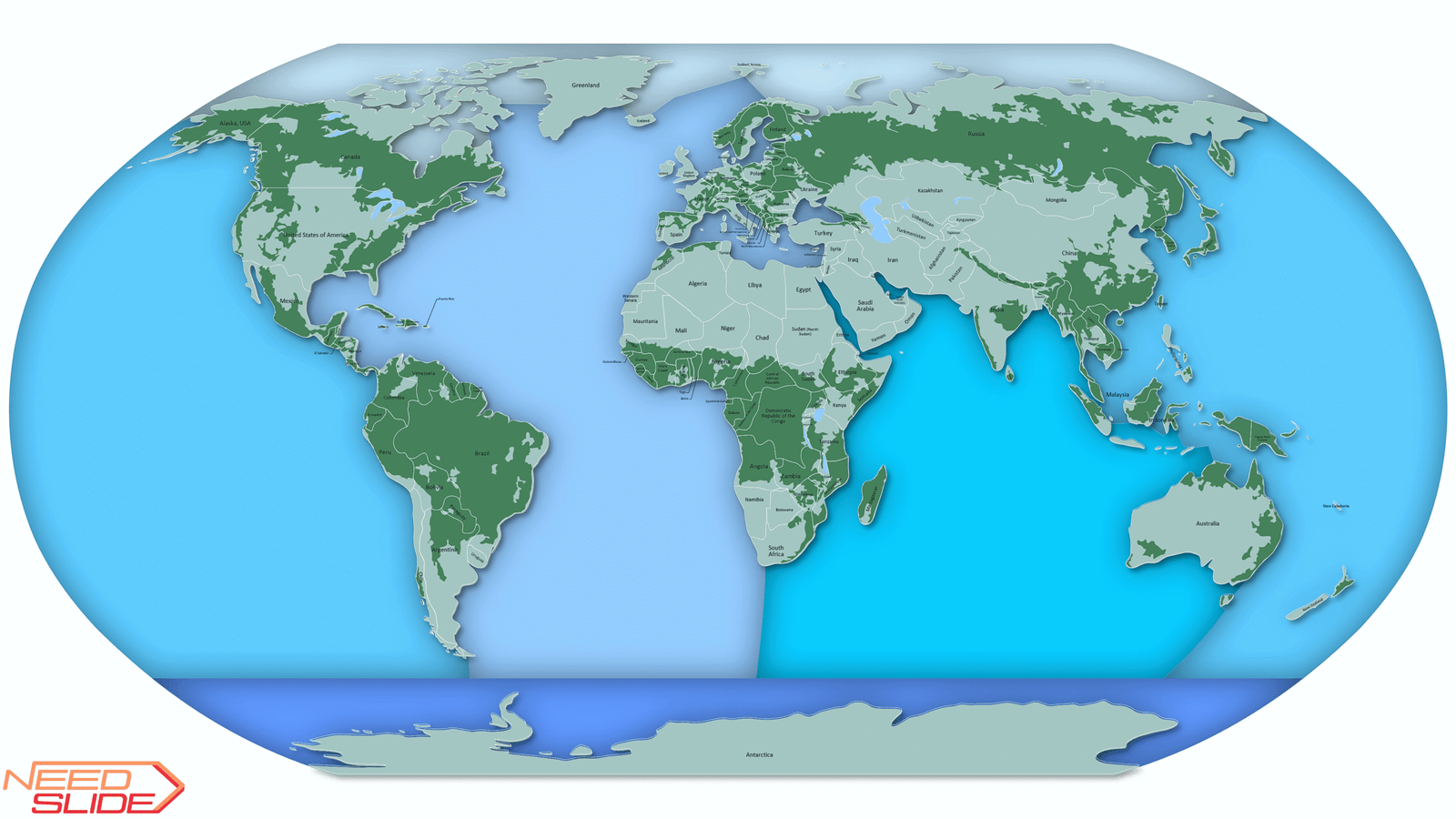
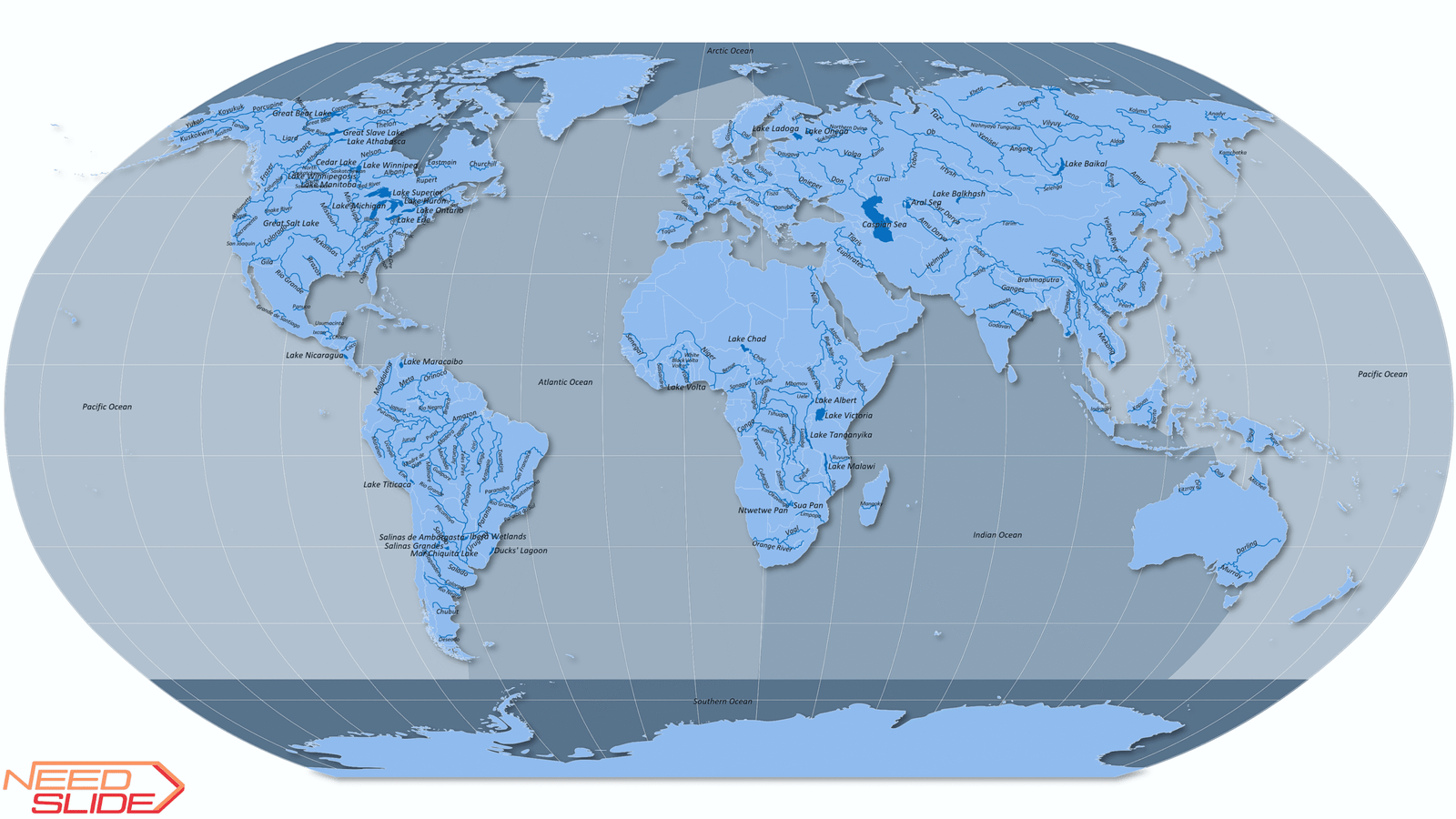
10. Layer Lakes:
- Low detail map: 17 as one object
- Normal detail map: 17 objects
- High detail map: 35 objects
11. Layer Rivers:
- Low detail map: no layer
- Normal detail map: 226 as one object
- High detail map: 226 objects
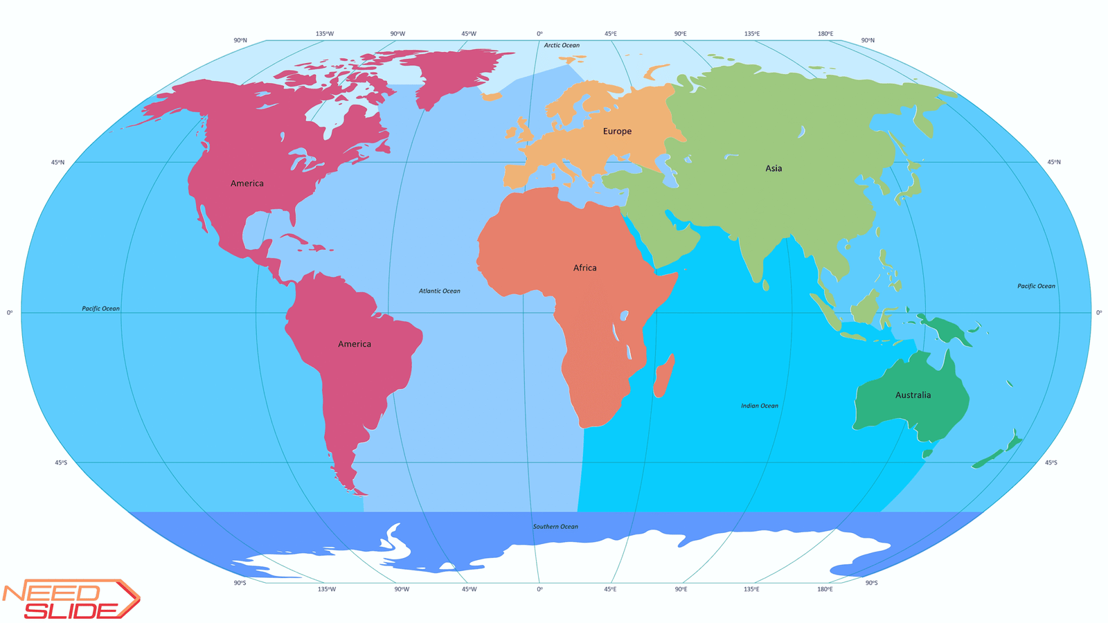
12. Layers Continents:
- Low detail map: 5 Continents (w/o Antarctica)
- Normal detail map: 6 Continents (Eurasia), 5 Continents (w/o Antarctica)
- High detail map: 7 Continents, 6 Continents (Eurasia), 6 Continents (America), 5 Continents (w/o Antarctica), and 4 Continents (Afro-Eurasia)
13. Layers Oceans:
- Low detail map: 5 Oceans
- Normal detail map: 5 Oceans
- High detail map: 7 Oceans, 5 Oceans, 4 Oceans, 3 Oceans
14. Layers Graticule:
- Low detail map: 45o
- Normal detail map: 30o and 45o
- High detail map: 10o, 15o, 20o, 30o and 45o
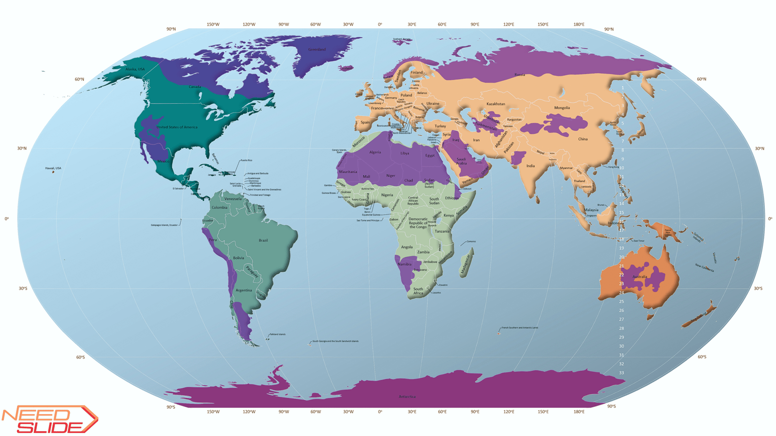
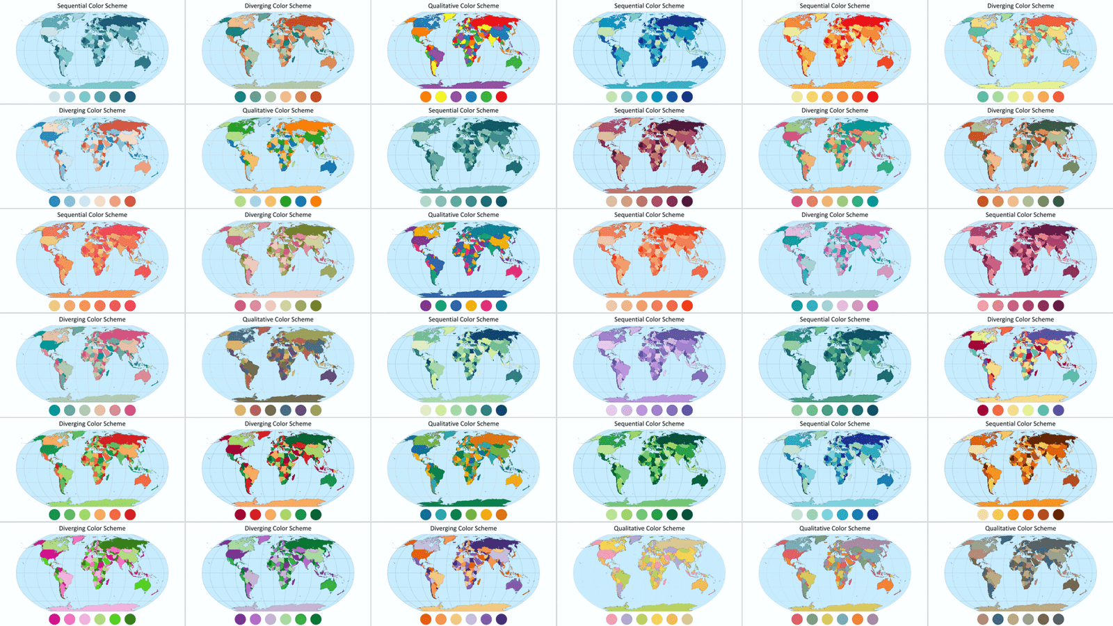
15. Color schemes:
- Low detail map: Includes 7 built-in cartographic color palettes (2 sequential, 3 diverging, and 2 qualitative)
- Normal detail map: Includes 15 built-in cartographic color palettes (5 sequential, 5 diverging, and 5 qualitative)
- High detail map: Includes 36 built-in cartographic color palettes (14 sequential, 14 diverging, and 8 qualitative)
16. Possible Layer Combinations (Number of Distinct Map Variants):
- Low detail map: at least 1,120 combinations using only top-level layers.
- Medium detail map: at least 59,136 combinations using only top-level layers.
- High detail map: at least 1,504,360 combinations using only top-level layers.
- With selective object use, the number increases by a factor of two orders of magnitude.
17. Layer management: All layers are organized on a single slide.
You can toggle visibility in the Selection Pane to customize the map view
18. Object naming: Each object is clearly labeled for easy identification and navigation. In the Countries and Territories and Capitals layers, objects are arranged by country names in the English alphabetical order (regardless of the language of the map). In the Lakes and Rivers layers, objects are arranged in the English alphabetical order (regardless of the language of the map).
19. Quick start guide: Comes with a concise instruction sheet to help you begin using the map immediately
Quick Start Guide: Includes a concise instruction sheet to help you get started using the map right away.
A little tip:
When you open a presentation file, you’ll see one slide that displays all layers simultaneously.
To get started quickly and comfortably, do the following:
1. Turn on the Selection Pane (Alt + F10)
2. Collapse all top layer levels (click on the arrows to the left of the layer names in the Selection Pane)
3. Click the Hide All button at the top of the Selection Pane; this will hide all layers.
4. By clicking on the eye icon to the right of the layer name, turn on only the layers you need.
5. If necessary, edit the properties and position of layers or individual objects, select a color scheme, or assign your own colors. Your map is ready.
6. Copy your map to your presentation or export it as needed.
Typical Use Cases for the Multilayer World Map for PowerPoint
1. Education & Training
Visualize geographical, political, and environmental concepts with customizable layers. Useful for classroom teaching, student projects, and academic presentations.
2. Business & Corporate Presentations
Showcase global operations, regional performance, logistics, or market expansion with flexible map views and built-in color schemes.
3. NGOs & International Organizations
Present program coverage, humanitarian outreach, or regional initiatives across countries and continents.
4. Design & Creative Projects
Build custom infographics, video slides, and presentations using clear layer control and editable vector elements.
5. Research & Publications
Embed clean, accurate map visuals into reports, papers, and data visualizations—with or without labels for a streamlined layout.
PLEASE NOTE:
This product is for personal use only and may not be sold, redistributed, or shared.
We hope you enjoy our world map tool. We would be grateful if you could share your impressions of our product. Thank you!
Gifts for you inside:
Low detail map:
1. Vector flag icons of international and regional unions and associations for PowerPoint
Normal detail map:
1. Vector flag icons of international and regional unions and associations for PowerPoint
2. Vector People Icon Creation Kit for PowerPoint
High detail map:
1. Vector flag icons of international and regional unions and associations for PowerPoint
2. Atlantic Ocean, Vector Orthographic World Map for PowerPoint (Globe)
3. Vector People Icon Creation Kit for PowerPoint
Instant Download
Your files will be available to download once payment is confirmed.


Irakli Mirian –
The best map of the world I have ever seen!
Many layers to use. Very convenient.